We use cookies to make your experience better. To comply with the new e-Privacy directive, we need to ask for your consent to set the cookies. Learn more.


Save Time Selecting Polygon Arcs with SMS 14.0
Working with complex polygon geometry is a common part of preparing a surface-water model in the Surface-water Modeling System (SMS). Polygons may contain multiple boundary arcs and interior holes, and selecting all of those arcs individually can become tedious when a project contains detailed or complex geometry. SMS 14.0 introduces the Select Polygon(s) Arcs command, making it easier to work with all of the arcs that define selected polygons and their holes.
The new command is available from the polygon context menu and works with both the Select Polygon and Universal Select tools. After selecting one or more polygons, users can right-click a selected polygon and choose Select Polygon(s) Arcs to select all of the arcs that make up the polygon boundaries and any holes within them. The command is included among the new Map Module improvements in SMS 14.0.
Simplify Complex Polygon Editing
SMS uses feature objects such as points, arcs, and polygons to build conceptual model geometry. Polygons can be used to define areas within a model domain, including areas associated with different meshing or modeling properties.
Consider a polygon representing a large material zone. The polygon might have dozens of vertices along its exterior boundary and several interior holes. Previously, selecting every boundary arc could require identifying and selecting the arcs individually. Select Polygon(s) Arcs provides a faster way to select the complete set of arcs associated with the polygon.
This is particularly useful when an operation needs to be performed on the polygon's underlying arcs rather than on the polygon itself.
Example 1: Editing a Complex Model Boundary
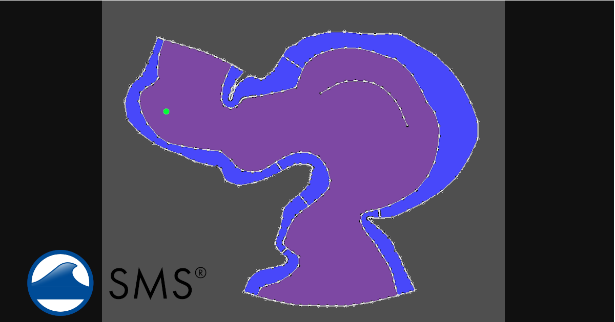
Suppose a model domain contains a large polygon representing the area to be meshed. The boundary has been divided into several arcs to represent changes in geometry, breaklines, or other model features.
Using the Select Polygon tool, select the polygon and choose Select Polygon(s) Arcs from the polygon's context menu. SMS selects all of the arcs defining the polygon.
The arcs can then be reviewed or edited as a group instead of manually selecting each individual arc. This can save time when working with detailed imported or manually constructed geometries.
Example 2: Working with Polygon Holes
The command is especially useful for polygons containing holes. A hole might represent an island, an excluded area, a structure footprint, or another area that should not be treated as part of the surrounding polygon.
For example, a coastal model domain could contain a polygon representing the computational area with several islands represented as holes. Selecting the polygon and using Select Polygon(s) Arcs selects both the outer boundary arcs and the arcs defining the interior holes.
This makes it easier to modify or inspect the complete polygon geometry without having to separately identify the arcs belonging to each hole.
Example 3: Preparing Geometry for Mesh Generation
Careful geometry preparation is an important part of mesh generation in SMS. The location and spacing of vertices along feature arcs can influence the resulting mesh, so reviewing and adjusting feature geometry before generating a mesh can be useful.
For example, a user may identify a polygon that contains overly detailed or unevenly spaced boundary geometry. Selecting the polygon and then selecting its arcs provides a convenient starting point for reviewing those arcs and applying appropriate geometry-editing operations.
This can be particularly useful when preparing geometry imported from GIS or CAD sources, where boundaries may contain more vertices than are necessary for the modeling objective.
Example 4: Selecting Multiple Polygon Boundaries
The command also supports workflows involving multiple selected polygons. Using the Universal Select tool, users can select the desired polygons and then use Select Polygon(s) Arcs to select the arcs associated with those polygons.
This can be useful when several adjacent regions require similar geometry edits. Rather than selecting the boundary arcs for each polygon individually, the polygon-based selection provides a more efficient way to identify the associated feature arcs.
A Small Tool with a Practical Impact
The Select Polygon(s) Arcs command is a relatively small addition to SMS 14.0, but it addresses a common geometry-editing task: moving from an area-based selection to the feature arcs that define that area.
By making it possible to select the boundary arcs and hole arcs directly from a selected polygon, SMS 14.0 makes complex Map Module geometry easier to manage. The command is especially useful for model domain preparation, GIS-derived geometry cleanup, polygon editing, and mesh preparation.
For users working with increasingly detailed model geometries, small improvements to selection and editing workflows can reduce repetitive work and make geometry preparation more efficient.
Download SMS 14.0 now to unlock better surface-water modeling.
November 3, 2026
|
View: 40
|
Categories: SMS
|
By: <a class="mp-info" href="https://aquaveo.com/blog/author/admin">Aquaveo Staff</a>
About the Author


Converting a NET File to an INP File
May 9, 2018
Performing a Silent Install of XMS (Passwords & Hardware Locks)
October 10, 2018
Computing Basin Curve Numbers in 9 Easy Steps
May 16, 2023
Performing a Silent Install for ALS
October 27, 2021
Tips for Finding Information on the XMS Wiki
September 25, 2019
Save Time Selecting Polygon Arcs with SMS 14.0
November 3, 2026
Smart Guide to MT3D vs MODPATH
October 27, 2026
How to Calibrate a HEC-HMS Model for Peak Flow Accuracy
October 20, 2026
Meet the New Display Panel
October 13, 2026
What’s New in the GMS 11.0 Beta
October 6, 2026