We use cookies to make your experience better. To comply with the new e-Privacy directive, we need to ask for your consent to set the cookies. Learn more.


Mastering CMS Sediment Mapping
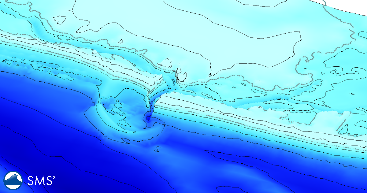
Understanding where sediment originates, how it moves, and where it is deposited can be an important part of coastal modeling. The Coastal Modeling System (CMS) includes sediment transport and morphology capabilities designed for coastal inlets, navigation channels, and adjacent beaches. With sediment mapping in CMS-Flow, modelers can track sediment from defined locations through a simulation and examine its movement and fate over time.
The sediment mapping workflow is now integrated into the Surface-water Modeling System (SMS) 14.0, making it easier to define sediment mapping areas and configure the associated model inputs without manually editing CMS files. SMS 14.0 provides an interface for sediment mapping coverage setup, bed-layer configuration, and dataset creation.
What Is CMS Sediment Mapping?
Traditional sediment transport modeling can show how much sediment is transported, deposited, or eroded throughout a model domain. Sediment mapping adds another useful perspective: tracking sediment associated with specific source areas.
This capability can be useful when investigating questions such as:
-
Where does sediment from a particular inlet or beach area travel?
-
Which areas receive sediment from a dredged channel?
-
How much sediment from a source region remains within the model domain?
-
Where does sediment become deposited during a simulation?
-
How do different sediment sources contribute to morphological change?
USACE research has described sediment mapping as a technique for “tagging” sediment in one location and mapping its path and fate through the end of a simulation. This provides a way to examine sediment pathways in addition to the overall sediment transport calculated by CMS.
Creating a Sediment Mapping Coverage
The workflow begins in SMS by creating a CMS-Flow sediment mapping coverage. The coverage provides the spatial definition needed to identify areas associated with sediment mapping.
This coverage-based approach is consistent with the broader SMS workflow of using map coverages to define spatial model information. Rather than manually constructing model input files, the sediment mapping interface allows the necessary information to be defined within SMS. SMS 14.0 then handles the associated dataset creation and model setup.
After creating the coverage, define the areas that will be used for sediment mapping. These areas can represent different sediment sources within the CMS model domain. For example, separate mapped regions could be used for a navigation channel, an inlet shoal, an adjacent beach, or another area where the origin of sediment is important to the study.
Defining Sediment and Bed Layers
Sediment mapping is particularly useful for models that need to distinguish sediment from different sources or track sediment through multiple bed layers.
CMS includes sediment transport and morphology calculations, and its sediment capabilities support spatially varying information such as sediment grain size and bed composition. For example, the CMS-Flow model can use a spatially varied D50 dataset to represent the median particle size across the model grid.
The sediment mapping workflow builds on this modeling framework by allowing the mapped sediment information to be associated with the CMS bed. In SMS 14.0, bed-layer configuration and dataset creation are incorporated into the sediment mapping interface, reducing the need to construct the supporting model files manually.
When preparing a model, consider how the available sediment survey information corresponds to the model's spatial resolution and the intended sediment-tracking question. A detailed sediment map does not necessarily provide additional value if the CMS computational grid cannot represent the same level of spatial detail.
A Typical CMS Sediment Mapping Workflow
A practical workflow for using sediment mapping with CMS can be summarized as follows:
-
Create or open the CMS-Flow model in SMS.
Establish the CMS computational grid and the other model components required for the simulation. -
Create a CMS sediment mapping coverage.
Use the Map Module to create the coverage associated with sediment mapping. -
Define sediment mapping areas.
Create the spatial regions representing the sediment sources or areas that need to be tracked. -
Configure the sediment mapping bed layers.
Define the appropriate bed-layer information for the sediment mapping analysis. -
Create the required datasets.
Use the SMS sediment mapping interface to generate the datasets associated with the coverage and bed-layer configuration. -
Add the sediment mapping information to the CMS-Flow simulation.
Verify that the sediment mapping coverage and associated datasets are included in the appropriate simulation. -
Run the CMS simulation.
CMS calculates hydrodynamics, sediment transport, and morphology while tracking the mapped sediment information. -
Review the sediment mapping results.
Examine the resulting spatial distributions and sediment pathways to determine where mapped sediment moves and accumulates.
This workflow keeps the spatial definition of sediment sources, bed information, and model datasets together in the SMS project rather than requiring users to manage those components independently.
Applications for Coastal Sediment Studies
Sediment mapping can be particularly valuable for navigation channel and inlet studies, where understanding sediment pathways can help explain recurring shoaling and sediment exchange.
For example, a modeler could identify sediment within an inlet shoal and use sediment mapping to investigate whether that material tends to migrate toward a navigation channel, adjacent beach, or another portion of the model domain. Similarly, multiple sediment source areas could be mapped to investigate how different portions of a coastal system contribute to sediment accumulation.
The technique can also complement dredging and sediment management studies. CMS is designed for applications involving navigation channel performance and sediment exchange, while CMS sediment mapping provides additional information about sediment movement and source-to-destination pathways.
Improve Sediment Tracking in CMS
CMS sediment mapping in SMS 14.0 provides a more integrated way to investigate sediment pathways in coastal and inlet models. By combining sediment mapping coverages, bed-layer configuration, and automatically created datasets within the SMS interface, the workflow reduces manual model-file preparation and makes sediment source tracking more accessible.
For projects where the question is not simply how much sediment moves, but where sediment comes from, where it goes, and how it contributes to changes within the model domain, sediment mapping provides an additional level of information for interpreting CMS results.
Make use of CMS’s sediment mapping capability and download SMS 14.0 now!
November 10, 2026
|
View: 14
|
Categories: SMS
|
By: <a class="mp-info" href="https://aquaveo.com/blog/author/admin">Aquaveo Staff</a>
About the Author


Converting a NET File to an INP File
May 9, 2018
Performing a Silent Install of XMS (Passwords & Hardware Locks)
October 10, 2018
Computing Basin Curve Numbers in 9 Easy Steps
May 16, 2023
Performing a Silent Install for ALS
October 27, 2021
Tips for Finding Information on the XMS Wiki
September 25, 2019
Mastering CMS Sediment Mapping
November 10, 2026
Save Time Selecting Polygon Arcs with SMS 14.0
November 3, 2026
Smart Guide to MT3D vs MODPATH
October 27, 2026
How to Calibrate a HEC-HMS Model for Peak Flow Accuracy
October 20, 2026
Meet the New Display Panel
October 13, 2026