We use cookies to make your experience better. To comply with the new e-Privacy directive, we need to ask for your consent to set the cookies. Learn more.

Working with Functional Surfaces for UGrids in SMS
The functional surface option in SMS allows viewing data above a geometry. It has been an option in the 2D Mesh module. The functional surface option has been added for unstructured grids (UGrids) in the UGrid module starting with SMS 13.2. This post will give some guidance and tips for using functional surfaces with UGrids.
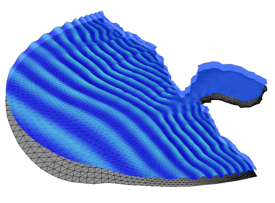
Functional surfaces use any dataset as the elevation value for the surface. One of their most common uses is as a representation of the surface of the water above a UGrid. For example, the ocean’s surface in a CGWAVE model. However, functional surfaces can use any scalar dataset to inform the elevations.
A UGrid functional surface gets created by the New Functional Surface UGrid right-click command in the Project Explorer. Once created, right-click on the newly created functional surface to edit the display options. The Functional Surface Options dialog allows you to fine tune the display of your UGrid functional surface. Furthermore, selecting Other Display Options brings up UGrid-style display options.
Once you've set up your functional surface, you may need to make adjustments. Here are some tips on adjusting your functional surface displays depending on your situation:
- If your dataset has large numbers, your functional surface might be very tall. To temper that effect, you could set the functional surface Z Magnification between 0 and 1.
- If your dataset has very small numbers, your functional surface might appear completely flat. To more clearly see the rise and fall of the data values, set the Z Magnification to a value greater than 1.
- If your functional surface is intersecting the UGrid, and you don't want it to, adjust the Elevation Z Offset.
- If you want to add contours to your functional surface, click Other Display Options and turn on Face contours. Then click Contours to open the Contour Options.
- If you still want to be able to see the UGrid through the functional surface, adjust the transparency. If you're using contours for the functional surface, you'll need to adjust the transparency in the Contour Options dialog.
- If you want the functional surface to reference a specific dataset for its elevation, specify a User defined dataset.
Try out functional surfaces with UGrids in SMS today!
January 3, 2023
|
View: 2226
|
Categories: SMS
|
By: <a class="mp-info" href="https://aquaveo.com/blog/author/admin">Aquaveo Staff</a>
About the Author

Performing a Silent Install of XMS (Passwords & Hardware Locks)
October 10, 2018
Converting a NET File to an INP File
May 9, 2018
Computing Basin Curve Numbers in 9 Easy Steps
May 16, 2023
Performing a Silent Install for ALS
October 27, 2021
Tips for Finding Information on the XMS Wiki
September 25, 2019
How to Determine Soil Texture Using NRCS Soil Data
June 16, 2026
Diagnosing Costly Model Stability Issues
June 9, 2026
New Display Enhancements in GMS 10.9
June 2, 2026
SMS 13.5 Beta Out Now!
May 26, 2026
Tips for Modeling Bridge Scour
May 19, 2026