We use cookies to make your experience better. To comply with the new e-Privacy directive, we need to ask for your consent to set the cookies. Learn more.

Importing and Cleaning Borehole Data
Borehole data is essential for building reliable stratigraphic models in groundwater simulations. In the Groundwater Modeling System (GMS), properly importing and cleaning this data helps ensure your conceptual and numerical models reflect real-world subsurface conditions.
The Borehole module in GMS is designed to visualize borehole data obtained from drilling logs or synthetic sources. It then builds 3D cross sections to show soil stratigraphy. Getting this step right is foundational to producing realistic aquifer models and avoiding costly interpretation errors.
Step 1: Prepare Your Borehole Data
Before importing data into GMS, make sure your borehole data is organized and in a supported format. GMS can read Excel files (*.xls, *.xlsx), text files (*.txt, *.csv), and database files. Each borehole should include:
-
Borehole ID
-
X and Y coordinates
-
Elevation or depth values
-
Stratigraphic unit or material names
Typically, each row represents a transition to a new soil layer. Ensure units are consistent. Your data may include:
-
Stratigraphy data detailing layers, contacts, and transitions
-
Sample data from continuous sampling methods like cone penetrometers or geophysical logs
Step 2: Import Borehole Data into GMS
Once your data is ready, do the following to import it into GMS:
-
Open GMS.
-
Go to File | Open… and select your borehole data
-
For text files, use the Text Import Wizard
-
During the import process, GMS will prompt you to map your file columns
-
Select Borehole Data as the object type
-
Once imported, the boreholes will appear in the Borehole module, viewable in both plan and cross-sectional views
You can adjust how boreholes are displayed to help with interpretation and clarity.
Step 3: Clean and Validate the Data
After importing, review your data for issues like overlapping depths, missing stratigraphy names, or unrealistic jumps in elevation. Use the Display Options or Materials macros to fix issues and align each borehole with the correct geologic units for your conceptual model.
GMS automatically assigns default material names, which you can rename and color-code for clarity. Turning on the material legend in the Graphics Window helps track materials during editing.
Step 4: Generate Cross Sections and Horizons
With clean data, you can start building your 3D model by generating cross sections and interpolating horizons.
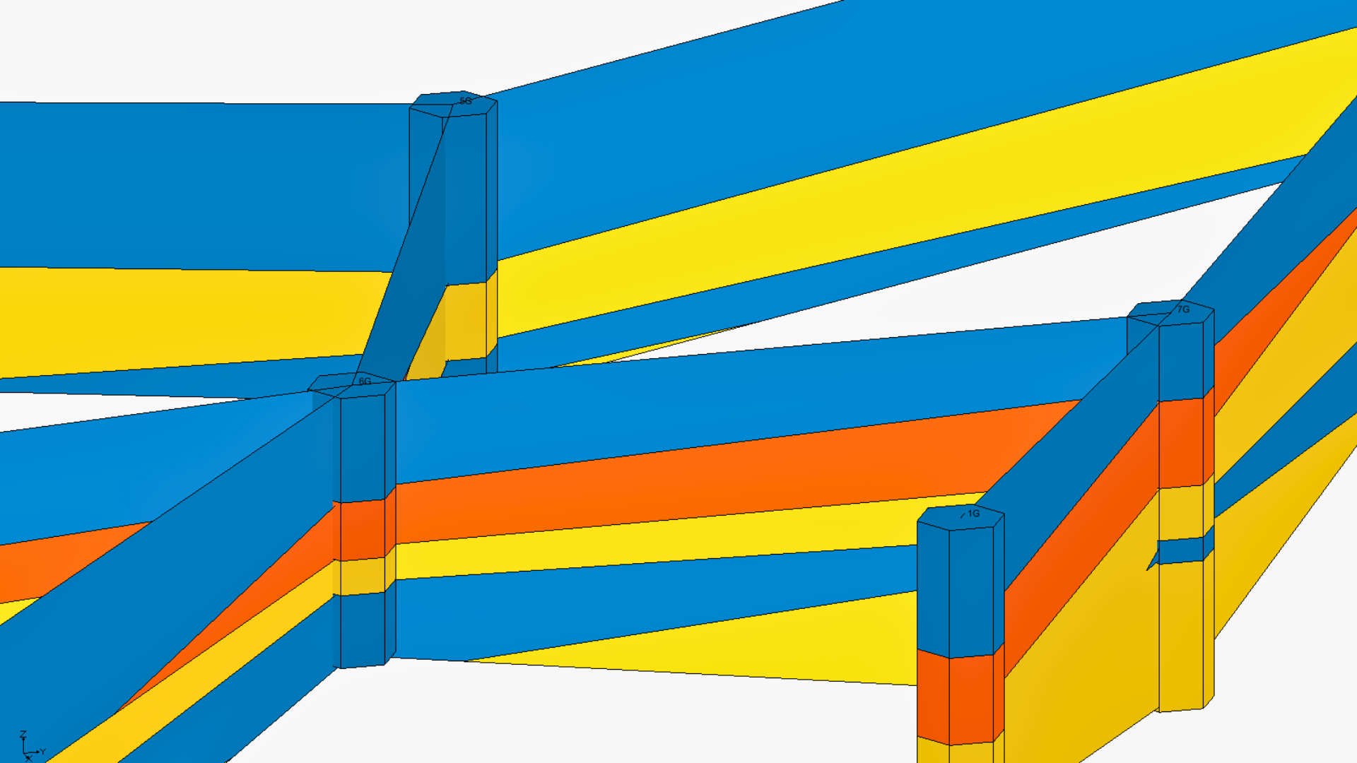
Creating Cross Sections
GMS offers many ways to create cross sections:
-
Auto-create lets GMS triangulates borehole locations
-
Manual allows selecting boreholes in sequence
-
Snap to surface will align cross-section lines to a surface like a TIN
Filling Cross Sections
Once blank sections are in place, fill them with soil materials:
-
Auto-fill allow GMS uses horizon IDs or materials
-
Manual fill uses the Cross Section Editor if boreholes differ or auto-fill in inaccurate
You can also edit multiple cross sections at once, which can be useful for modeling regional geologic trends.
Building with Clean Data
Accurate borehole data is essential for effective groundwater modeling. By carefully importing, cleaning, and interpreting your data in GMS, you can build realistic stratigraphy and minimize modeling errors. Whether conducting site investigations or full aquifer simulations, taking the time to do model your boreholes effectively pays off in model reliability.
Download GMS to import your borehole data today!
June 24, 2025
|
View: 4225
|
Categories: GMS
|
By: <a class="mp-info" href="https://aquaveo.com/blog/author/admin">Aquaveo Staff</a>
About the Author

Performing a Silent Install of XMS (Passwords & Hardware Locks)
October 10, 2018
Computing Basin Curve Numbers in 9 Easy Steps
May 16, 2023
Converting a NET File to an INP File
May 9, 2018
Performing a Silent Install for ALS
October 27, 2021
Tips for Finding Information on the XMS Wiki
September 25, 2019
SMS 13.5 Beta Out Now!
May 26, 2026
Tips for Modeling Bridge Scour
May 19, 2026
Essential Guide to WMS Rain-on-Grid Modeling
May 5, 2026
Best Practices for Modeling Complex Geometries
April 28, 2026