We use cookies to make your experience better. To comply with the new e-Privacy directive, we need to ask for your consent to set the cookies. Learn more.

Contours from Raster and Features from Raster
Two new tools in the most recent version of theToolbox for Aquaveo’s GMS, SMS, and WMS (collectively known as XMS) are the Contours from Raster and the Features from Raster tools, which can be found in the “Coverages” folder of the toolbox. These tools can be a great way to use rasters to quickly generate coverages with contours or specific features such as streams and roadway embankments.
The Contours from Raster tool takes the elevation data from a raster and uses it to generate a contour coverage. This generates contours lines along the elevations at specified intervals. This can be useful for a number of things including, in some cases, a simple way to see where to define domains and boundaries for your project.
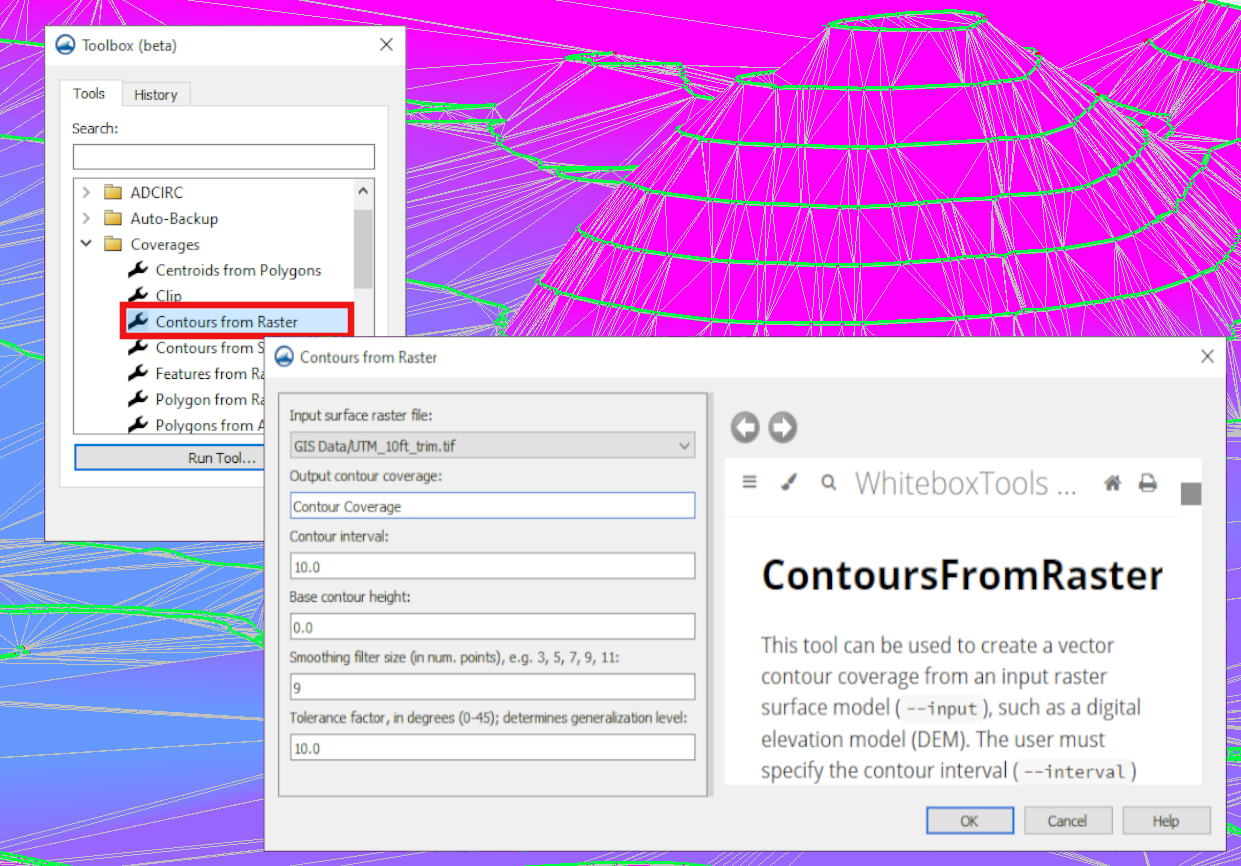
To generate this contour coverage using the Contours from Raster tool, you’ll need these components:
- A surface raster file loaded into the project.
- A contour interval you want for your project.
- Base contour height appropriate for your project.
- Smoothing filter size (in num. points), which should be an odd number.
- Tolerance factor between 0 and 45 degrees. This determines the generalization level.
The Features from Raster tool generates features like streams and roadway embankments based on the elevation data from a raster. This tool can minimize the need to draw these features by hand. The inputs required for this tool are:
- An input elevation raster loaded into the project.
- The feature type which can be either stream or ridge.
- The threshold area.
- The pre-processing engine appropriate for your project:
- rho8 – Computes flow directions and accumulations using the Rho8 algorithm.
- Whitebox full workflow – Computes flow directions and accumulations using the Whitebox tool full workflow algorithm that uses a standard D8 method for computing flow directions.
Rasters often contain a large number of data points, so it may be beneficial to use the Smooth Raster tool or Feature Preserving Smoothing tool on the raster before using it to create contours or features. Alternatively, the Clean command can be useful for tidying up feature objects after the coverage has been generated.
Go to any of the XMS software to try out these new tools as a way to create coverages for your project today!
About the Author

Performing a Silent Install of XMS (Passwords & Hardware Locks)
October 10, 2018
Tips for Finding Information on the XMS Wiki
September 25, 2019
Aquaveo 2024 in Review
December 30, 2024
Help with Flow Direction and Accumulation
December 17, 2024
New Tool for Locked Nodes Datasets
December 13, 2024
Enhanced Structure Options for CMS-Flow
April 8, 2025
Employing Hydraulic Conductivity in MODFLOW 6
April 1, 2025
Applying Hard Bottom Data to Your CMS Simulations
March 25, 2025
Optimizing the Graphics Window in SMS 13.4
March 18, 2025
Troubleshooting Well Exclusions in MODFLOW
March 11, 2025