We use cookies to make your experience better. To comply with the new e-Privacy directive, we need to ask for your consent to set the cookies. Learn more.

Enhanced Structure Options for CMS-Flow
Are you looking to include structures in your coastal models using the Surface-water Modeling System (SMS)? Adding hydraulic structures can greatly enhance your coastal simulations. That’s why the 13.4 beta release of the SMS introduces exciting new capabilities for defining and simulating various structures in the CMS-Flow model, offering you greater control as you model your project.
It's really important to represent them accurately when you're developing coastal management strategies and making sure hydrodynamic models are correct.
Structure Types in CMS-Flow
Of the four different structure types available for use in CMS-Flow, three are new to SMS with the most recent update: weirs, culverts, and tide gates. In addition to the rubble mounds option, each of these structure types allows you to define key attributes that influence the flow of water and sediment. You can access these structure types by right-clicking the arc and selecting the Assign arc attributes… command or right-clicking the polygon and selecting the Assign polygon attributes… command.
The available types of structures are as follows:
-
Weirs: Arcs can be assigned attributes to represent weirs in a simulation, allowing water to flow over hydraulic barriers. Specific attributes can be modified to accurately fit the project and correctly model water surface elevations and discharge rates between bodies of water.
-
Culverts: With the new culvert feature, you can represent water flowing under roadways or embankments. Culverts are defined by arcs, and you can specify their shape (box or circle), dimensions, length, and whether or not they have flap gates.
-
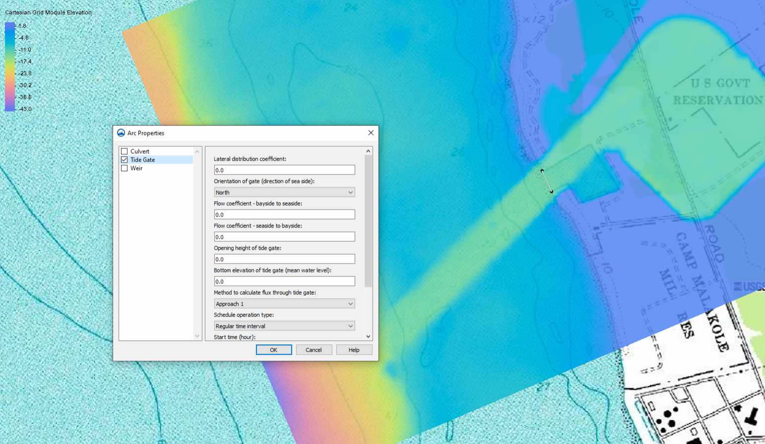
Tide Gates: Tide gates, like weirs and culverts, are represented by arcs, allowing for advanced coastal environment modeling. Tide gates offer flexibility when defining parameters (height, elevation, flow coefficients) and scheduling water flow operation (regular time intervals, designated time intervals, or ebb and flood tides).
-
Rubble Mounds: In addition to the new structure options developed for 13.4, rubble mound structures can be created using polygons. These structures can have attributes like rock diameter, porosity, and base depth that influence flow and sediment transport calculations.
The recent enhancements to CMS-Flow provide a wider range of options to help make your coastal models more precise and informative. Including these structures in your simulation means you’ll have a much clearer idea of the complex water movement and behavior happening in the areas you’re studying. With these updates to CMS-Flow, you can confidently tackle challenges and deliver more reliable predictions for your projects.
Want to improve your coastal modeling simulations? Download SMS 13.4 today!
April 8, 2025
|
View: 4577
|
Categories: SMS
|
By: <a class="mp-info" href="https://aquaveo.com/blog/author/admin">Aquaveo Staff</a>
About the Author

Performing a Silent Install of XMS (Passwords & Hardware Locks)
October 10, 2018
Converting a NET File to an INP File
May 9, 2018
Computing Basin Curve Numbers in 9 Easy Steps
May 16, 2023
Performing a Silent Install for ALS
October 27, 2021
Tips for Finding Information on the XMS Wiki
September 25, 2019
Diagnosing Costly Model Stability Issues
June 9, 2026
New Display Enhancements in GMS 10.9
June 2, 2026
SMS 13.5 Beta Out Now!
May 26, 2026
Tips for Modeling Bridge Scour
May 19, 2026