We use cookies to make your experience better. To comply with the new e-Privacy directive, we need to ask for your consent to set the cookies. Learn more.
Defining UGrids Layer Attributes in GMS
In your groundwater model, do you need to define MODFLOW-USG attributes for a UGrid that vary by layer? For example, you might have multiple polygons that define your recharge zones for your model where the attributes on each polygon are only meant to be applied to specific layers on the UGrid. GMS provides tools for specifying how those attribute definitions get applied to UGrids.
First, you can always apply attributes directly to a UGrid using the grid approach. Doing this has the advantage of having direct control over the attributes assigned to each cell and element on each layer. However, doing this on a large UGrid or for more complex models, this can become tedious and time consuming. Using the conceptual model can aid in managing assigning attributes to layers in more complex models.
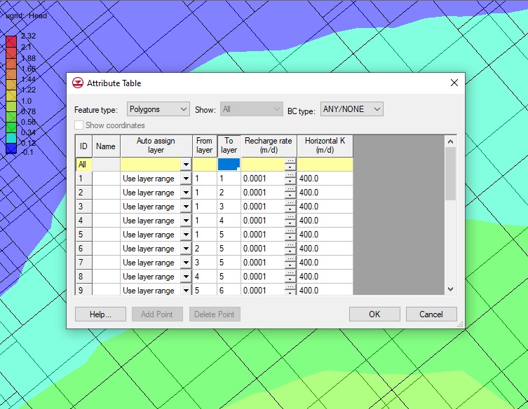
For the conceptual model approach, the Coverage Setup allows you to specify the layer range for sources, sinks, boundary conditions, and areal properties. The Layer range option must be turned on in order to specify the layer range for attributes applied to feature objects in the coverage. If Layer range option is not applied then the default layer range will be used when applying attributes on the coverage to the UGrid.

It should be noted that once you have chosen to assign attributes to specific layers, you will need to pay attention to which attributes are being assigned. It is recommended that you review the assigned MODFLOW attributes. Keep in mind that you cannot mix specified layer ranges with the default layer range. GMS does not give priority to the default layer range over the specified layer ranges and vice versa. For example, if you assign refinement attributes to a polygon to use a specific layer range, but leave other polygons on the same coverage to use the default layer range for refinement, this will likely cause issues in the model run or results.
GMS allows you to be as general or specific as you need when assigning MODFLOW attributes to UGrid layers. Try out defining the layer attributes for UGrids in GMS today!


