We use cookies to make your experience better. To comply with the new e-Privacy directive, we need to ask for your consent to set the cookies. Learn more.

Converting Solids to Scatter Sets in GMS
-
Generating Scatter Sets from Solids in GMS
-
Creating Elevation Data for Groundwater Modeling
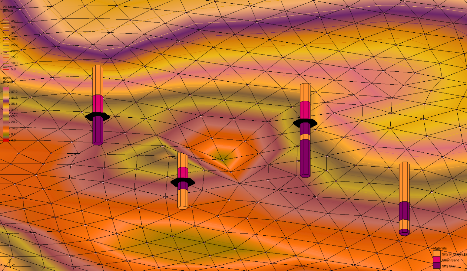
Ever struggled to extract elevation data from solid models in the Groundwater Modeling System (GMS)? Whether you’re refining simulations or integrating them with other tools, getting that data into a usable format is crucial. To refine simulations, integrate with other modeling projects, or enhance data visualization, you need a way to extract and convert it into a usable format. In GMS, elevation data is represented as either scatter sets (points) or rasters (grids), both of which play a vital role in various groundwater modeling applications.
Fortunately, while there’s no direct conversion tool available in GMS, there are several alternative methods you can use for your projects. These methods utilize triangulated irregular networks (TINs) and borehole data—the same data typically used to create the solids—to generate scatter sets for simulation purposes.
Having multiple ways to extract and convert this data allows you the flexibility of exporting, sharing with others, and applying the results to different grids and models. Whether you need to refine your simulations, integrate with external software, or present data in a more accessible format, these approaches can be excellent solutions to optimize your model.
Here’s how you can generate scatter sets from solid models in GMS:
Using TINs to Create Scatter Sets
If your solids were created from TINs:
-
Right-click the TIN in the Project Explorer.
-
Select Convert To | 2D Scatter Points to generate a scatter set.
Extracting Elevation Data from Boreholes
For solids based on boreholes:
-
Select the borehole data and use Select Contacts to identify material boundaries.
-
Right-click the boundary and select Auto Select to choose similar contacts.
-
Right-click the display area and select Contacts → 2D Scatter Points to create a scatter set.
Mapping Solid Models with UGrids
For direct extraction from solid models:
-
Export each split as a “*.sol” file.
-
Convert the related TIN to a UGrid by selecting Convert To | UGrid.
-
In the Toolbox, use the Map Solids option to apply solid data to the UGrid.
-
Convert the UGrid datasets to a point dataset, then export as a “Text Tab Delimited UGrid Point File (*.txt)”.
-
Import the file back into GMS as 2D Scatter Points via the Import Wizard dialog.
Any of these alternate methods that use TINs, borehole data, or the indirect UGrid approach are easy and effective ways to use elevation data in your groundwater modeling projects. Each approach provides flexibility depending on your specific dataset and project requirements, allowing you to choose the best method based on the data you have available.
Download GMS and utilize elevation in solids for your groundwater modeling projects today!
April 22, 2025
|
View: 4773
|
Categories: GMS
|
By: <a class="mp-info" href="https://aquaveo.com/blog/author/admin">Aquaveo Staff</a>
About the Author

Performing a Silent Install of XMS (Passwords & Hardware Locks)
October 10, 2018
Computing Basin Curve Numbers in 9 Easy Steps
May 16, 2023
Converting a NET File to an INP File
May 9, 2018
Performing a Silent Install for ALS
October 27, 2021
Tips for Finding Information on the XMS Wiki
September 25, 2019
SMS 13.5 Beta Out Now!
May 26, 2026
Tips for Modeling Bridge Scour
May 19, 2026
Essential Guide to WMS Rain-on-Grid Modeling
May 5, 2026
Best Practices for Modeling Complex Geometries
April 28, 2026