We use cookies to make your experience better. To comply with the new e-Privacy directive, we need to ask for your consent to set the cookies. Learn more.

Simplifying Watershed Modeling with Rho8 Tools
-
Leveraging Rho8 Tools for Watershed Modeling
-
Using Rho8 Tools for Watershed Modeling
-
Optimize Water Flow Analysis Using Rho8
Are you looking for efficient ways to understand how water moves across the landscape of your modeling project? Sometimes, coordinating a model with multiple flow directions can be complex. Fortunately, the Watershed Modeling System (WMS) features tools such as Rho8 Flow Directions and Rho8 Flow Accumulation, which use simple, single-flow-direction methods. These tools help show how water might move across your terrain, aiding in the accuracy and efficiency of your models.
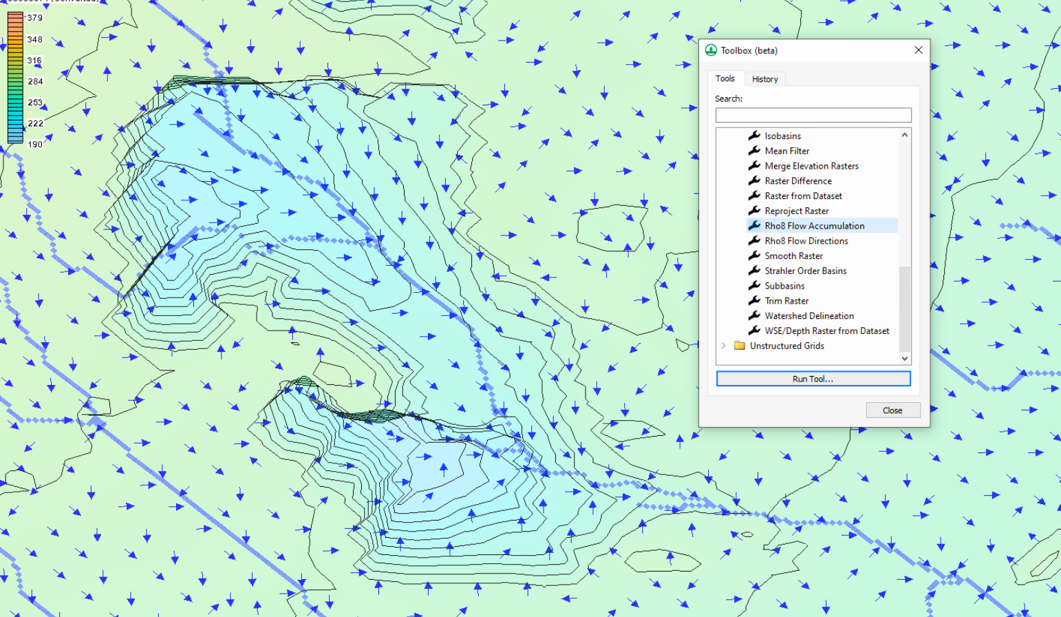
Simplify Flow Analysis with Rho8 Flow Directions
The main function of the Rho8 Flow Directions tool is to create a flow pointer grid using the Rho8 algorithm. This tool simplifies the analysis by determining a single downslope neighbor for each grid cell to which water will flow. Unlike methods that consider flow divergence, Rho8 establishes one clear path of movement from each cell to the next. The primary goal is to establish a base raster layer that shows how water flows across your Digital Elevation Model (DEM).
By selecting your input DEM raster file (and seeing if it adheres to the ESRI D8 flow direction scheme), you can quickly create an output raster that maps these simplified flow paths. The focus with the Rho8 Flow Directions tool isn’t on exploring every possible flow route; it’s on establishing a clear representation of how water is likely to move based on the terrain.
Identify Accumulation Zones with Rho8 Flow Accumulation
Building directly on the grid created using the Rho8 Flow Directions tool, the Rho8 Flow Accumulation tool helps to calculate the contributing area for each grid cell. Using the flow paths defined by the grid, this tool measures the total area that contributes water flow to each cell. The essential purpose of this tool is to identify areas within your watershed where water is likely to converge and accumulate. This data is essential for many hydrological uses, like identifying watershed boundaries and flood zones.
Various options with the Rho8 Flow Accumulation tool—options such as log-transforming the output values or clipping the view—can aid the visuals of your modeling in many ways. This tool’s output can be customized to fit your specific requirements, such as providing the number of inflowing cells, the contributing area, or the total catchment area.
Enhancing Your Models with Rho8 Tools
The true strength of these tools is in their simple yet efficient way of focusing on a single flow direction. While other methods may offer more in-depth representations of flow, the purpose of the Rho8 tools is to provide a clear, foundational understanding of flow pathways and accumulation areas. When needing a model for initial analyses, large datasets, or when a simpler flow representation is all you need, using the Rho8 tools is a great decision.
Download WMS today to start using Rho8 for your modeling projects!
April 15, 2025
|
View: 4640
|
Categories: WMS
|
By: <a class="mp-info" href="https://aquaveo.com/blog/author/admin">Aquaveo Staff</a>
About the Author

Performing a Silent Install of XMS (Passwords & Hardware Locks)
October 10, 2018
Converting a NET File to an INP File
May 9, 2018
Computing Basin Curve Numbers in 9 Easy Steps
May 16, 2023
Performing a Silent Install for ALS
October 27, 2021
Tips for Finding Information on the XMS Wiki
September 25, 2019
Diagnosing Costly Model Stability Issues
June 9, 2026
New Display Enhancements in GMS 10.9
June 2, 2026
SMS 13.5 Beta Out Now!
May 26, 2026
Tips for Modeling Bridge Scour
May 19, 2026