We use cookies to make your experience better. To comply with the new e-Privacy directive, we need to ask for your consent to set the cookies. Learn more.
Computing Basin Curve Numbers in 9 Easy Steps
Need to predict direct runoff or infiltration from rainfall excess? Computing a curve number (CN) is a common solution to this problem. The curve number method was developed by the USDA Natural Resources Conservation Service using empirical analysis of runoff from small catchments and hillslope plots.
To calculate a CN you will need the hydrologic soil groups, land use data, and rainfall conditions for a given area. You then need to enter the values for the CN equation to get your final values. While you could calculate a CN manually, WMS can do the work for you.
- Import data for the area, either as map coverages or as GIS data. It is import that you review this data for accuracy before using it to compute a curve number. Required data includes land use data and soil type data.
- Create a land use ID table file. This can be done in any text editor and should be saved as a standard text file. Examples can be found in the XMSWiki and in the TR-55 manual.
- Make the Hydrologic Modeling module the active module.
- Select the Compute GIS Attributes command in the Calculators menu.
- In the Compute GIS Attributes dialog, select the SCS Curve Number option.
- Select the coverage or GIS layers to use for the calculation.
- Import the land use table file by clicking the Import button and selecting the land use table text file.
- Once your options are set, click OK to generate your curve numbers.
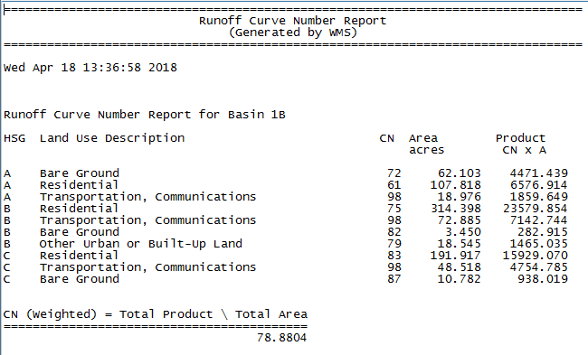
- If needed, in the View Data File dialog, select the text editor to use to see your final curve number results. This dialog may not appear if a default text editor has been selected.

Now you can review the curve numbers in your text file. Try calculating Curve Numbers in WMS Community Edition today!


