We use cookies to make your experience better. To comply with the new e-Privacy directive, we need to ask for your consent to set the cookies. Learn more.
Using Rasters with Map to MODFLOW
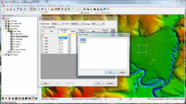
For some time GMS has included the capability to use TINs with the Map->MODFLOW command. The next version of GMS will also include the capability to use Rasters with the Map->MODFLOW command similar to how TINs can be used now. In the conceptual model, the user will associate the desired Raster with the Head/Elevation assigned to a point, node, arc, or polygon. When the Map->MODFLOW command is executed the Head/Elevation for the boundary condition is extracted from the Raster using the cell center where the boundary condition is applied. The figure below shows how/where the Raster can be assigned to a point/node/arc/polygon.


