We use cookies to make your experience better. To comply with the new e-Privacy directive, we need to ask for your consent to set the cookies. Learn more.


Best Practices and Tips for Using SWMM with WMS
The Storm Water Management Model (SWMM) is widely used for analyzing urban drainage, stormwater runoff, and sewer systems. When combined with the Watershed Modeling System (WMS), users can take advantage of WMS tools for watershed delineation, GIS data processing, and model setup while using SWMM for hydrologic and hydraulic simulation. Following a few best practices can make the WMS SWMM workflow more efficient and help produce more reliable results.
Start with Accurate Terrain and GIS Data
A successful SWMM model begins with accurate spatial data. Before building the model, verify that your Digital Elevation Model (DEM), land use, soil, and other GIS datasets use appropriate coordinate systems and cover the entire study area. WMS provides tools for processing terrain data and delineating drainage areas, helping establish a strong spatial foundation for the SWMM model.
Pay particular attention to the DEM resolution. A highly detailed DEM is useful for small urban watersheds, but unnecessarily large datasets can increase processing time without improving the model.
Review Subcatchment Delineation
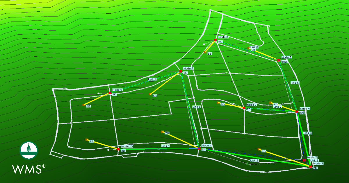
SWMM represents runoff using subcatchments that drain to nodes within the drainage network. WMS can help automate watershed delineation and calculate important basin characteristics.
After delineating subcatchments, review the results rather than accepting them automatically. Compare basin boundaries with aerial imagery, known drainage patterns, storm drains, and topographic features. Small errors in drainage areas can affect runoff volumes and peak flows.
Use Consistent Hydrologic Parameters
SWMM uses parameters such as subcatchment area, width, slope, imperviousness, and infiltration parameters to calculate runoff. Make sure these values are physically reasonable and consistent with the available GIS and field data.
Avoid changing multiple parameters simultaneously during calibration. Adjusting one group of parameters at a time makes it easier to understand how each change affects the model response.
Check the Drainage Network
Before running a simulation, carefully review SWMM nodes, links, outfalls, storage units, and other hydraulic components. Verify that pipes and channels connect to the correct nodes and that elevations and dimensions are reasonable.
EPA's SWMM documentation emphasizes that the model represents runoff from subcatchments and routes that flow through drainage system components such as pipes, channels, storage units, pumps, and regulators.
Review Time Steps and Results
SWMM supports both single-event and continuous simulations. Select simulation periods and computational time steps appropriate for the storm and drainage system being modeled. After running the model, review hydrographs, node depths, conduit flows, and potential flooding rather than relying only on a single peak-flow value.
Finally, compare model results with observed data whenever possible. Calibration and validation can identify problems with rainfall inputs, watershed parameters, or hydraulic connectivity before the model is used for design or decision-making.
Build Better SWMM Models with WMS
Using WMS with SWMM provides a practical workflow for combining spatial watershed data with detailed stormwater modeling. By carefully preparing terrain data, reviewing subcatchments, checking hydraulic connectivity, and validating results, modelers can create more reliable SWMM models in WMS and spend less time troubleshooting their projects.
Get SWMM with WMS today!
September 8, 2026
|
View: 644
|
Categories: WMS
|
By: <a class="mp-info" href="https://aquaveo.com/blog/author/admin">Aquaveo Staff</a>
About the Author


Converting a NET File to an INP File
May 9, 2018
Performing a Silent Install of XMS (Passwords & Hardware Locks)
October 10, 2018
Computing Basin Curve Numbers in 9 Easy Steps
May 16, 2023
Performing a Silent Install for ALS
October 27, 2021
Tips for Finding Information on the XMS Wiki
September 25, 2019
Meet the New Display Panel
October 13, 2026
What’s New in the GMS 11.0 Beta
October 6, 2026
Simplify and Prepare Complex Geometry
September 29, 2026
Unlock SMS 14.0 Map Undo Features
September 22, 2026
Advanced Groundwater Modeling Techniques for 3D Data
September 15, 2026