We use cookies to make your experience better. To comply with the new e-Privacy directive, we need to ask for your consent to set the cookies. Learn more.
Discover the Refine UGrid Tools in SMS
The Surface-water Modeling System (SMS) continues to expand its capabilities. Currently, SMS is expanding to make more use of unstructured grids. An unstructured grid (UGrid) is a flexible geometric object that can include cells such as 2D and 3D cells with any number of faces and nodes. This flexibility allows for more realistic modeling of geological features.
In SMS, UGrids can be imported directly or created by converting an existing geometry such as a 2D mesh, 2D scatter set, Quadtree or map feature objects. When creating an UGrid from an existing geometry, it is usually best to make certain the geometry already refined to the level you need for your project. However, sometimes the Ugrid needs to be refined after it has been generated or imported. To do this, SMS provides two tools for refining UGrids: Refine UGrid and Refine UGrid by Error.
Both tools are located in the SMS Toolbox under the Unstructured Grids folder.
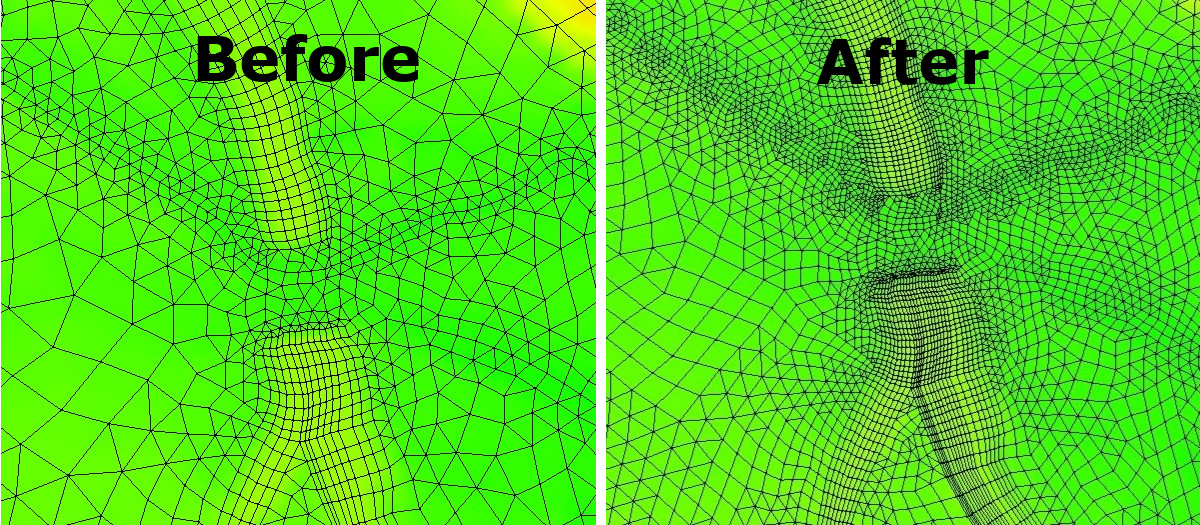
The Refine Ugrid uses an existing UGrid then splits (refines) the elements into smaller elements. The Refine UGrid tool provides you with the option to select datasets with “locked” nodes—any node with a non-zero scalar value. Any cell edges that contain one or more locked nodes will not be split. Utilizing such a tool will equip you to complete a surface-water modeling project with focused accuracy and efficiency. .

Similar to the Refine UGrid tool, the Refine UGrid by Error tool produces a 2D UGrid that has been refined as a result of an existing 2D UGrid, however this tool integrates elevation rasters into the process. Entering a value that guides the acceptable error threshold, the maximum number of iterations to perform, and the necessary elevation rasters are all required components of the input parameters for this tool.
Being able to refine UGrids adds increased accuracy for your surface-water projects in SMS. Check out the refine UGrid tools in SMS today!


