We use cookies to make your experience better. To comply with the new e-Privacy directive, we need to ask for your consent to set the cookies. Learn more.

Accessing 3DEP Data for SMS
The Surface-water Modeling System (SMS)[2] continues to expand the types of data it can use for your water modeling projects. For models in the United States, there is a very comprehensive set of elevation data that you can use in your modeling–3DEP data.
3DEP data is an amalgamation of high-resolution 3D elevation and 3D hydrography data from multiple sources. It is also "bare earth," meaning the images are ground-level only. No buildings, trees, shrubs, or ground cover of any sort have been included. Seeing the most precise shape of the ground can be very important to surface modeling. The high quality lidar data in the 3DEP project covers the vast majority of the United States and several of its territories. Coverage is becoming more comprehensive over time. We have added 3DEP as one of our options when you import map elevation information from the web.
When creating a surface-water model, you are looking for the USGS 3DEP Bare Earth DEM (North America) option from the web.
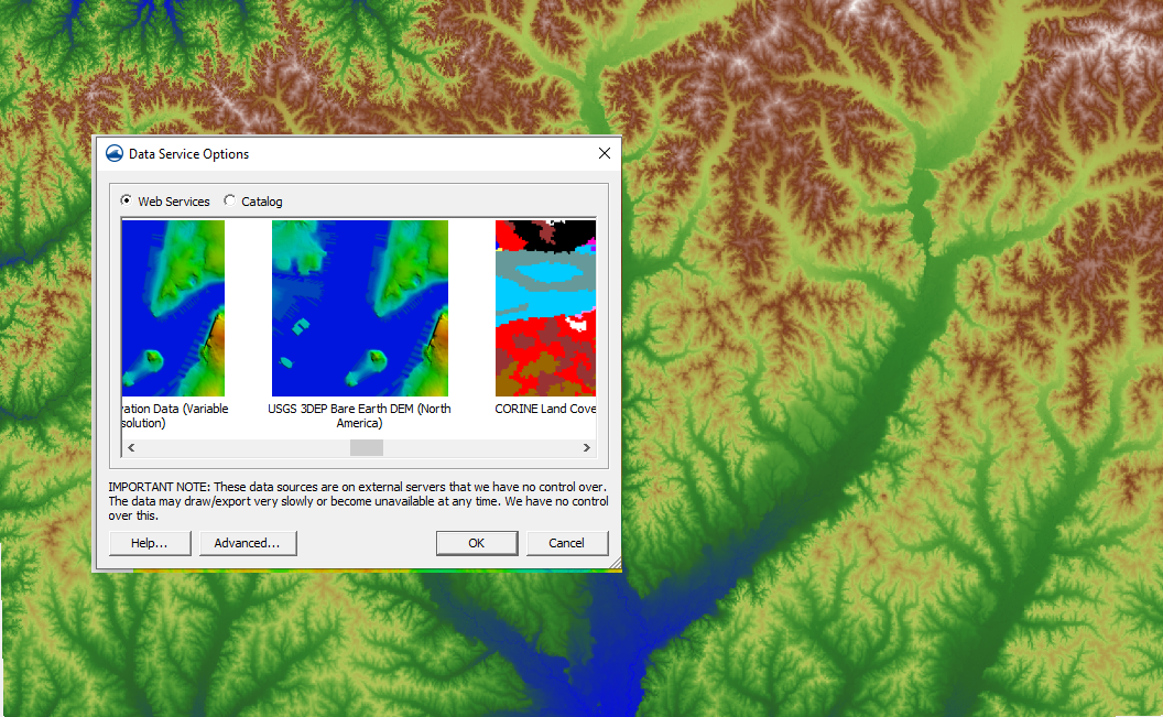
To access 3DEP data in SMS, do the following:
- Click File | Import from Web… to open the Virtual Earth Map Location.
- Make your location selection here (United States and some territories only)
- You may have to set your Display Projection settings
- When you reach the Data Service Options dialog box, scroll right until you see an option for USGS 3DEP Bare Earth DEM (North America).
- You then save your image to the appropriate location on your computer, after you set or accept the default raster cell size.
Once you have saved your image, it will show up in the Project Explorer window under GIS Data. When saving, it will add the " _elevs.tif" extension to the name you chose. The elevation data can then be applied to your model in the usual way.
Head on over to SMS and see how 3DEP data can help your surface-water modeling.
June 11, 2024
|
View: 3088
|
Categories: SMS
|
By: <a class="mp-info" href="https://aquaveo.com/blog/author/admin">Aquaveo Staff</a>
About the Author

Performing a Silent Install of XMS (Passwords & Hardware Locks)
October 10, 2018
Computing Basin Curve Numbers in 9 Easy Steps
May 16, 2023
Converting a NET File to an INP File
May 9, 2018
Performing a Silent Install for ALS
October 27, 2021
Tips for Finding Information on the XMS Wiki
September 25, 2019
Comparing Multiple Design Alternatives in One Project
April 7, 2026
Incorporating MODFLOW 6 Groundwater Energy (GWE)
March 31, 2026
Essential DEM Clean-Up for Watershed Delineation
March 24, 2026
Essential Boundary Condition Guide
March 17, 2026
How to Delineate a Well Capture Zone Using MODPATH
March 10, 2026