We use cookies to make your experience better. To comply with the new e-Privacy directive, we need to ask for your consent to set the cookies. Learn more.

World Bank ArcHydro Groundwater Training
Recently, Aquaveo had the opportunity to participate in an ArcHydro Groundwater training organized by the World Bank. The online training happened from the 9th to the 12th of November 2021.
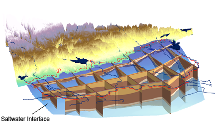
The training covered the uses and applications of the ArcHydro Groundwater (AHGW) tool used with ArcGIS. AHGW aids in displaying and analyzing multidimensional groundwater data, including representations of aquifers and wells/boreholes, 3D hydrogeologic models, temporal information, and data from simulation models.
Topics covered in the 4-day training included setting up a groundwater model and working with boreholes data. Other topics covered further included creating wells and cross sections in groundwater models, along with performing model analysis.
The training had 30 active participants in attendance from the National Water Informatics Centre (NWIC), the National Hydrology Project (NHP), the National Institute of Hydrology (NIH), the Water Resources Department (WRD) of the Indian Institute of Remote Sensing, and ESRI. For the online training, participants were located in various states in India including: Kerala, Karnataka, Uttar Pradesh, Tamil Nadu, Sikkim, West Bengal, Odisha, Telangana, Maharashtra, Gujarat, and Rajasthan.
Aquaveo would like to thank the World Bank for setting up this online training. We'd also like to thank all of the participants for their interest and efforts in using AHGW.
If you are interested in attending a training session for AHGW or any of Aquaveo's products, check out our training page for upcoming training sessions. Training sessions can be either in-person or online. Additionally, you can request a training session from Aquaveo by contacting our consulting team.
November 17, 2021
|
View: 2721
|
Categories: AHGW
|
By: <a class="mp-info" href="https://aquaveo.com/blog/author/admin">Aquaveo Staff</a>
About the Author

Performing a Silent Install of XMS (Passwords & Hardware Locks)
October 10, 2018
Computing Basin Curve Numbers in 9 Easy Steps
May 16, 2023
Converting a NET File to an INP File
May 9, 2018
Performing a Silent Install for ALS
October 27, 2021
Tips for Finding Information on the XMS Wiki
September 25, 2019
Essential DEM Clean-Up for Watershed Delineation
March 24, 2026
Essential Boundary Condition Guide
March 17, 2026
How to Delineate a Well Capture Zone Using MODPATH
March 10, 2026
How to Decide between Structured or Unstructured Grids
March 3, 2026
Storing Time Series Data Using the Spatial Data Coverage
February 24, 2026