We use cookies to make your experience better. To comply with the new e-Privacy directive, we need to ask for your consent to set the cookies. Learn more.

Using a Shapefile with the Fast Flood Tool
Do you have a shapefile with water surface elevation data you would like to use towards quickly generating floodplain data? WMS can help you with this. The Map Flood tool, sometimes called the Fast Flood tool, has a new feature we have developed that will allow you to use shapefiles as part of the process of generating floodplain data. This post will review how to use shapefiles for fast flood mapping in WMS.
Using a shapefile with the Map Flood tool can be done by using the following workflow:
- Use any of the methods to open files to import your shapefiles into your WMS project. If your shapefile coordinates are geographic, WMS may ask you to convert them to a planimetric coordinate system for computational use, in which case, click OK to accept this.
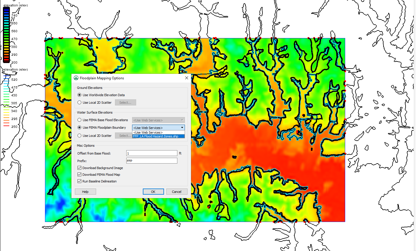
- The shapefile should now be visible under GIS Data. Click on the Map Flood macro to open the Floodplain Mapping Options dialog.
- Under the Water Surface Elevations section of the dialog, click on Use FEMA Floodplain Boundary and select your shapefile from its associated drop-down and after making any other changes, click OK to close the dialog.
- The Virtual Earth Map Locator may appear if there is not a set projection. Use it to navigate to the location of your shapefile then click OK after making any other changes. Navigation can either be done by inputting latitude and longitude or typing in the location you wish to observe.
- A message may appear saying that the feature requires a global projection. Click OK on this to bring up the Display Projection dialog.
- Review the projection to make certain it is correct, click OK to close the Display Projection dialog and run the floodplain delineation.
- After the Map Flood tool finishes, you will have all the necessary data downloaded, and the floodplain will have been generated.
Importing a shapefile into the project will have allowed it to be used with the Map Flood tool instead of needing to download the shapefile. This can save you time and provide consistency when generating multiple floodplains using the Map Flood tool. This also allows you to use a shapefile generated from the first use of Map Flood tool for additional floodplain generation in the same area.
Try out using shapefiles for fast flood mapping in WMS 11.1 today!
About the Author

Performing a Silent Install of XMS (Passwords & Hardware Locks)
October 10, 2018
Converting a NET File to an INP File
May 9, 2018
Computing Basin Curve Numbers in 9 Easy Steps
May 16, 2023
Performing a Silent Install for ALS
October 27, 2021
Tips for Finding Information on the XMS Wiki
September 25, 2019
Troubleshooting Projection and Coordinate System Issues
June 23, 2026
How to Determine Soil Texture Using NRCS Soil Data
June 16, 2026
Diagnosing Costly Model Stability Issues
June 9, 2026
New Display Enhancements in GMS 10.9
June 2, 2026
SMS 13.5 Beta Out Now!
May 26, 2026