We use cookies to make your experience better. To comply with the new e-Privacy directive, we need to ask for your consent to set the cookies. Learn more.

Enhancements to the 3D UGrid from Rasters Tool
Groundwater models start with a solid foundation. When you can quickly turn surface and subsurface elevation data into a 3D mesh, the rest of the work becomes a lot more productive. GMS has supported this for years through the 3D UGrid from Rasters tool, and now it has been upgraded to make creating geologic frameworks even smoother.
This tool helps you convert raster surfaces (such as DEMs or interpolated stratigraphic horizons) into a full 3D unstructured grid. It removes much of the manual effort often required when building the base geometry for MODFLOW 6 and other groundwater simulations.
What’s Improved
Users can now combine raster datasets with existing 2D UGrids to define stratigraphic layers. The workflow remains familiar, just more flexible for real-world terrain and geology.
The tool also generates an optional CSV output that lists layer and sub-layer elevations. That file can feed directly into the override grid layers option for when using the mapping from coverage workflow for MODFLOW 6. Less hand editing, fewer mistakes, and a clearer record of how the grid was built.
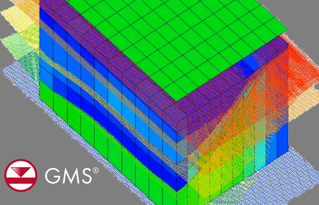
From Data to 3D UGrid: The Workflow
- Import your elevation and horizon sources
Surface data can come from boreholes, TINs, coverages, raster catalogs, or online rasters using Get Online Maps. - Build a conceptual model as needed
Set up boundaries, wells, and other hydrogeologic features in the Map module so the resulting grid supports your simulation design. - Create the 3D UGrid from Rasters
The tool extrudes your 2D UGrid between raster horizons to produce a stacked 3D grid. Layers maintain consistent horizontal discretization. Zero-thickness layers are allowed to simplify MODFLOW 6 compatibility. - Move straight into MODFLOW 6
With both a UGrid and a ready-to-use CSV, linking to MODFLOW 6 becomes a quick, predictable step.
Why This Matters
Accurate grids take time. These enhancements help cut that time down without cutting corners. With a streamlined path from raster data to a 3D model structure you trust, you spend more of your project on analysis and calibration rather than grid assembly.
Try the Updated Workflow
The enhanced 3D UGrid from Rasters tool is available now in GMS. Give it a spin and see how much faster your next model setup can be.
October 28, 2025
|
View: 1829
|
Categories: GMS
|
By: <a class="mp-info" href="https://aquaveo.com/blog/author/admin">Aquaveo Staff</a>
About the Author

Performing a Silent Install of XMS (Passwords & Hardware Locks)
October 10, 2018
Computing Basin Curve Numbers in 9 Easy Steps
May 16, 2023
Converting a NET File to an INP File
May 9, 2018
Performing a Silent Install for ALS
October 27, 2021
Tips for Finding Information on the XMS Wiki
September 25, 2019
Tips for Modeling Bridge Scour
May 19, 2026
Essential Guide to WMS Rain-on-Grid Modeling
May 5, 2026
Best Practices for Modeling Complex Geometries
April 28, 2026
Managing MODFLOW 6 Data: Lists, Copy Period & CSVs
April 21, 2026