We use cookies to make your experience better. To comply with the new e-Privacy directive, we need to ask for your consent to set the cookies. Learn more.

Streamlining Watershed Analysis with AGWA
If you work with GSSHA, then you'll definitely want to check out the Automated GSSHA Watershed Analysis, or AGWA, app. AGWA is an online web application for managing proposed changes to watershed models. The app is powered by GSSHA--a hydrologic model developed by the U.S. Army Corps of Engineers.
AGWA is web-based and therefore can be used from anywhere as long as you have an internet connection and a web browser. It includes simple step-by-step workflows to help you break down a more complex watershed analysis. These workflows can be applied to any number of GSSHA projects. The current workflows include:
- Detention Basin Analysis
- Culvert Resize Analysis
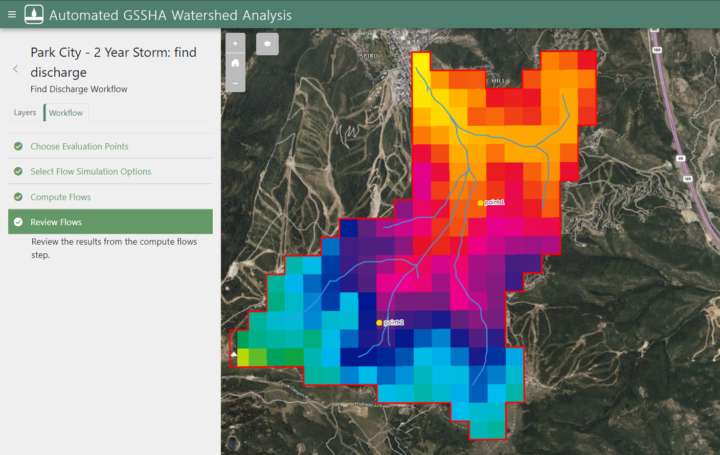
- Find Discharge Tool
- Land Use Change Analysis
AGWA uses the Tethys platform for managing accounts and access to projects. The GSSHA Models page in AGWA shows a list of all the GSSHA projects that are available for your account. The list includes the project name, project creator, description, and date of creation for each project. You can also view details about the model or the model map from the GSSHA Models page.
Clicking the launch button next to a GSSHA project on the GSSHA Models page will take you to the Model Summary page, which includes two tabs: the Summary tab and the Workflows tab. The Summary tab shows a summary of the GSSHA model including the name and description, map preview, creation date, and a list of scenarios. The Workflows tab shows all workflows that have been created or started, and is where you can create a new workflow.
All completed AGWA workflows have options to view the output data as plots. You can also download the flow and time series data as a CSV file so that you can use the results of your finished workflow outside of AGWA.
Check out AGWA, the app that lets you use GSSHA from anywhere! Follow this link to see a more complete list of the components of AGWA.
April 9, 2024
|
View: 3223
|
Categories: AGWA
|
By: <a class="mp-info" href="https://aquaveo.com/blog/author/admin">Aquaveo Staff</a>
About the Author

Performing a Silent Install of XMS (Passwords & Hardware Locks)
October 10, 2018
Computing Basin Curve Numbers in 9 Easy Steps
May 16, 2023
Converting a NET File to an INP File
May 9, 2018
Performing a Silent Install for ALS
October 27, 2021
Tips for Finding Information on the XMS Wiki
September 25, 2019
Managing MODFLOW 6 Data: Lists, Copy Period & CSVs
April 21, 2026
5 Concepts for Mastering Surface-water Modeling
April 14, 2026
Comparing Multiple Design Alternatives in One Project
April 7, 2026
Incorporating MODFLOW 6 Groundwater Energy (GWE)
March 31, 2026
Essential DEM Clean-Up for Watershed Delineation
March 24, 2026