We use cookies to make your experience better. To comply with the new e-Privacy directive, we need to ask for your consent to set the cookies. Learn more.

Working with Large DEMs
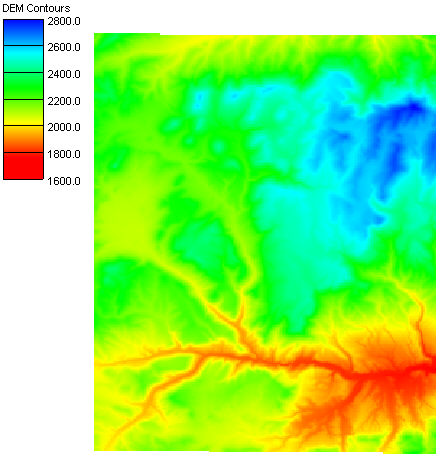
Do you have a project that requires using a large DEM? Digital Elevation Model files are a great source for terrain data in WMS. A lot of projects require using DEMs which makes it important to use the data available.
Using a large DEM file can present some complications in WMS. A large file may cause the program to slow down or have difficulty processing. So it is important to make certain to use a DEM that contains mostly relevant data and doesn’t contain an excess of nonessential information.
But how do you know if the DEM data you are pulling is enough? Is more watershed data always better?
Pulling in more data doesn’t insure better results. Though WMS is able to handle a massive amount of data (which is not a guarantee) the hardware in your computer may not be able to handle it. In general, a DEM twice the size of your watershed is probably sufficient for most models. More than twice your watershed size tends to just bog down the model causing you to face unnecessary wait times.
What should you do if your watershed data is not loading?
If your data is taking a long time to load try adjusting the resolution. After using the Get Data from Map tool, and making your selection in the Data Service Options dialog, you will be able to select your desired resolution in the Zoom dialog. Selecting a lower resolution zoom level should make the DEM easier to work with in WMS.
You could also try breaking up the DEM into multiple DEMs. That way your computer is not overwhelmed by trying to download one huge file all at once. Then while you’re working on your model you can turn on just the DEM(s) you need.
Third party software can be used to break up the DEM or reduce the resolution.
DEMs remain an excellent source for data for projects in WMS. Download WMS today!
November 6, 2019
|
View: 1330
|
Categories: WMS
|
By: <a class="mp-info" href="https://aquaveo.com/blog/author/admin">Aquaveo Staff</a>
About the Author

Performing a Silent Install of XMS (Passwords & Hardware Locks)
October 10, 2018
Computing Basin Curve Numbers in 9 Easy Steps
May 16, 2023
Converting a NET File to an INP File
May 9, 2018
Performing a Silent Install for ALS
October 27, 2021
Tips for Finding Information on the XMS Wiki
September 25, 2019
Essential DEM Clean-Up for Watershed Delineation
March 24, 2026
Essential Boundary Condition Guide
March 17, 2026
How to Delineate a Well Capture Zone Using MODPATH
March 10, 2026
How to Decide between Structured or Unstructured Grids
March 3, 2026
Storing Time Series Data Using the Spatial Data Coverage
February 24, 2026