We use cookies to make your experience better. To comply with the new e-Privacy directive, we need to ask for your consent to set the cookies. Learn more.

Master Surface-water to Groundwater Interactions in MODFLOW
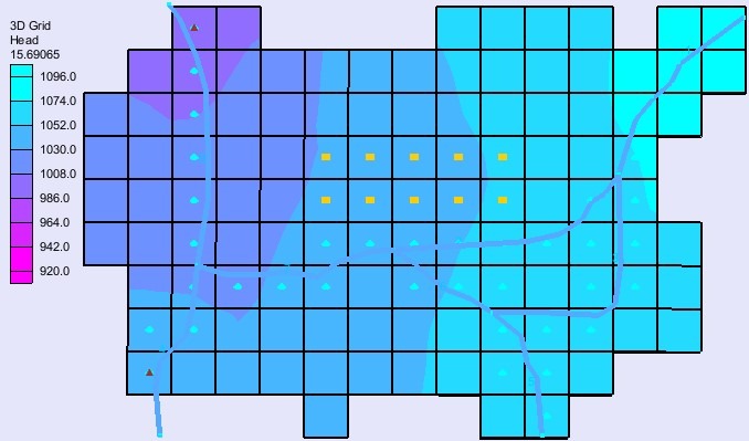
Surface water and groundwater don’t exist in isolation—they’re constantly exchanging in rivers, wetlands, lakes, and aquifers. For engineers, scientists, and decision-makers, understanding these interactions is essential for water budgets, flood management, climate impact assessments, and ecosystem health. While there are many numeric models that can simulate either surface-water or groundwater, MODFLOW has the capacity to model the interaction between the two.
The Groundwater Modeling System (GMS) makes it easy to couple surface water and groundwater models using MODFLOW packages and specialized tools. Instead of juggling disconnected datasets, GMS brings everything together into one powerful platform. Here’s how you can do it.
Step 1: Build a Strong Conceptual Model
Start by defining both your surface water and groundwater features. With GMS, you can use GIS layers, DEMs, and shapefiles to digitize rivers, lakes, or canals. From there, assign hydrogeologic properties to aquifers and aquitards. A well-structured conceptual model ensures the foundation of your simulation is accurate.
Step 2: Choose the Right MODFLOW Packages
GMS supports multiple MODFLOW packages for simulating surface water–groundwater interactions. Each package offers unique advantages:
-
RIV (River Package): Simulates river–aquifer exchange using stream stage and streambed conductance.
-
SFR2 (Streamflow Routing): Handles connected stream networks with seepage and unsaturated flow beneath streambeds.
-
LAK (Lake Package): Models dynamic lake levels as they interact with groundwater.
-
GHB (General Head Boundary): Represents constant head conditions for external aquifers or boundary water bodies.
Pro tip: If you’re modeling a complex river system, SFR2 provides more advanced capabilities than RIV.
Step 3: Assign Hydrologic Inputs
Input accurate data for streamflow, recharge, lake stages, and evapotranspiration. GMS allows inputting observed hydrologic records or outputs from models like HEC-HMS or SWAT, ensuring that your simulations reflect real-world conditions. Surface-water data from Aquaveo’s other products, such as the Surface-water Modeling System (SMS), can often be imported into GMS as a raster, scatter set, or DEM.
Step 4: Run and Calibrate Your Model
Once your model is set up, run MODFLOW within GMS and compare results against observed groundwater heads and streamflows. Use calibration tools like PEST to fine-tune recharge rates, hydraulic conductance, and aquifer properties. Calibration is where your model transforms from theory into decision-ready insights.
Why This Matters
Coupling surface water and groundwater models in GMS provides a holistic view of hydrologic systems. Whether you’re planning new infrastructure, evaluating water rights, or assessing environmental impacts, this approach delivers the precision you need to make confident, data-driven decisions.
Take the Next Step
Ready to bring your surface water and groundwater models together? Download GMS today and start building simulations that reveal the full picture of your water system.
September 16, 2025
|
View: 5658
|
Categories: GMS
|
By: <a class="mp-info" href="https://aquaveo.com/blog/author/admin">Aquaveo Staff</a>
About the Author

Performing a Silent Install of XMS (Passwords & Hardware Locks)
October 10, 2018
Computing Basin Curve Numbers in 9 Easy Steps
May 16, 2023
Converting a NET File to an INP File
May 9, 2018
Performing a Silent Install for ALS
October 27, 2021
Tips for Finding Information on the XMS Wiki
September 25, 2019
Tips for Modeling Bridge Scour
May 19, 2026
Essential Guide to WMS Rain-on-Grid Modeling
May 5, 2026
Best Practices for Modeling Complex Geometries
April 28, 2026
Managing MODFLOW 6 Data: Lists, Copy Period & CSVs
April 21, 2026