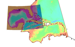
WAM
Wave Prediction Modeling with SMS

Application:Coastal Modeling
Method:2D
Developer:The WAMDI Group
Why WAM with SMS?
SMS provides a custom interface to the WAM model offering a simple way to set model parameters and a graphical user interface to run the model and visualize the results. Gather background data from a variety of sources from GIS to CAD and access online data from numerous databases of maps, images, and elevation data. SMS allows you to interact with models in true 3D taking advantage of optimized OpenGL graphics and to create photo-realistic renderings and animations for PowerPoint, print, and web presentations.
Try SMS Free for 14 Days >Purchase SMS with WAM >
WAM Description:
The WAM interface in SMS contains tools to create and edit WAM simulations. WAM is a third generation global ocean wave prediction model. The model predicts directional spectra as well as wave properties such as significant wave height, mean wave direction and frequency, swell wave height and mean direction, and wind stress fields corrected by including the wave induced stress and the drag coefficient at each grid point at chosen output times.
The model is continually updated to incorporate the latest results of research. The verification has been carried out in three areas National Oceanic and Atmospheric Administration (NOAA) moored buoys are available on the global Telecommunications System (GTS).


