We use cookies to make your experience better. To comply with the new e-Privacy directive, we need to ask for your consent to set the cookies. Learn more.
MODPATH
Particle Tracking with MODFLOW & GMS

Application:Groundwater Transport Modeling
Method:Finite Difference
Model Type:3D
Developer:U.S. Geological Survey
Why MODPATH with GMS?
GMS provides a custom interface to the MODPATH model offering a simple way to set model parameters and a graphical user interface to run the model and visualize the results. Gather background data from a variety of sources from GIS to CAD and access online data from numerous databases of maps, images, and elevation data. GMS allows you to interact with models in true 3D taking advantage of optimized OpenGL graphics and to create photo-realistic renderings and animations for PowerPoint, print, and web presentations.
Try GMS Free for 14 Days >Purchase GMS with MODPATH >
MODPATH Description:
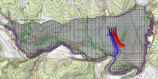
MODPATH is a particle tracking code that is used in conjunction with MODFLOW. After running a MODFLOW simulation, the user can designate the location of a set of particles. The particles are then tracked through time assuming they are transported by advection using the flow field computed by MODFLOW. Particles can be tracked either forward in time or backward in time. Because of the user-friendly interface in GMS, an intimate knowledge of MODPATH is not required to effectively do particle tracking in GMS. Particle tracking analyses are particularly useful for delineating capture zones or areas of influence for wells.
MODPATH was developed by the U.S. Geological Survey. Version 5.0 of MODPATH is supported in GMS. The version of MODPATH distributed with GMS is the original public domain version distributed by the USGS, with minor modifications to accommodate GMS.
