We use cookies to make your experience better. To comply with the new e-Privacy directive, we need to ask for your consent to set the cookies. Learn more.
Hydrology Projects - Compton Creek and Dominguez Channel Flood Mitigation Study
Los Angeles County Flood Control District

Overview
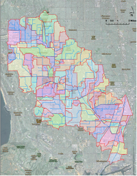
- HEC-HMS model of 110 sq. mi. urban watersheds
- Development of custom LiDAR processing tools
- "What-if" mitigation scenarios analyzed
Applied Software
- WMS (HEC-HMS, MODRAT, XPSWMM)
- SMS (TUFLOW)
Problem
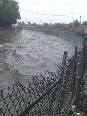
A study conducted by Los Angeles County Flood Control District determined that some of the levees along Compton Creek and Dominguez Channel could not be certified due to hydraulic deficiencies. Rather than expanding the hydraulic capacity of the channels by building up the levees, the County contracted with a consulting team led by Willdan Engineering to examine the Compton Creek and Dominguez Channel watersheds to determine possible flood mitigation projects at the watershed level.
Solution
 Aquaveo performed the majority of the hydrologic and hydraulic analysis which involved building a calibrated hydrologic model of each basin to determine the current 1 percent annual-chance flow rates in each channel. Stormwater was routed throughout the watershed using channel and storm drain information obtained from County as-built plans. The existing conditions models were then used to evaluate the impact of potential mitigation projects and identify those most suitable for reducing peak flow rates in the channels.
The County also exercised several optional tasks to develop design level models using County hydrologic methods for surface runoff and XPSWMM for subsurface conveyance. The models were used to quantify the local impact of several high priority mitigation projects in the basins.
Benefits
The project satisfied the requirements of several agencies including the US Army Corps of Engineers, FEMA, and Los Angeles County. The project also led to several improvements in WMS for LIDAR data processing and hydrologic model setup. Several features related to HEC-HMS and storm drain modeling were enhanced.