We use cookies to make your experience better. To comply with the new e-Privacy directive, we need to ask for your consent to set the cookies. Learn more.
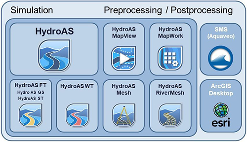
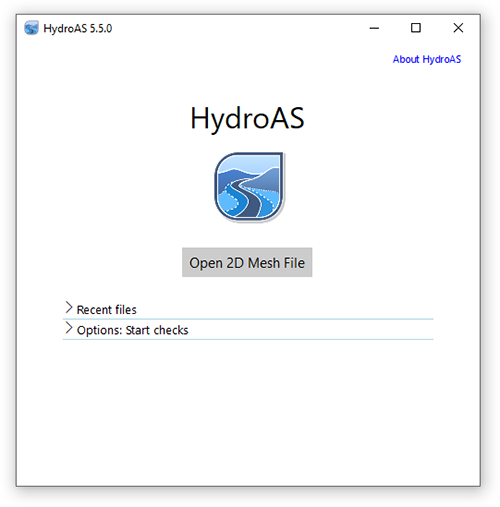
HydroAS
Hydrodynamic Flow & Transport Modeling with SMS
Application:Riverine Modeling
Method:2D Finite Volume
Developer:Hydrotec
Website:www.hydrotec.de/en/hydroas/
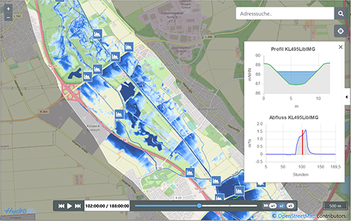
New Module HydroAS MapView and HydroAS MapWork in Version 5
 HydroAS MapView generates interactive map animations from HydroAS results that show the progression of a flood caused by heavy rain or a flood event. See example river Erft.
 HydroAS MapWork offers an additional data processor for HydroAS. It allows to transfer terrain data in raster format directly from the desktop GIS into the hydraulic model. Information between the digital terrain model and the hydraulic model is passed efficiently and without loss. HydroAS MapWork also processes data from large area models with high performance.
Why HydroAS with SMS?
SMS supports HydroAS through the Generic Model Interface offering a simple way to set model parameters and visualize the results. SMS allows you to interact with models in true 3D taking advantage of optimized OpenGL graphics and to create photo-realistic renderings and animation for PowerPoint, print, and web presentations.
HydroAS V 5 is compatible with SMS 12.2 and newer releases.
HydroAS Description:
 HydroAS is market leader in Germany, Switzerland and Austria. It is based on the numerical solution of the shallow water equations using the Finite-Volume-Method.
HydroAS has a wide range of applications including hydrodynamic river, costal and heavy rainfall / urban flash flood modeling.
With HydroAS FT additional modules for bed load transport up to 12 grain dimensions, wash load and pollution / heat transport can be applied. They use the 2step method for the discharge calculation which corresponds to the explicit second-order Runge-Kutta method. Highly transient processes, such as in the case of dam break wave propagation, can be successfully simulated.
HydroAS-GPU/MP - the parallel execution of simulation optimized for graphics cards or multi processors is also available.
HydroAS is available with an English and German user interface. Versions for Windows and Linux are offered.
HydroAS is characterized by:
- High stability, robustness and exactness for a wide spectrum of hydrodynamic conditions
- Short calculating time, also for millions of elements
- High computational accuracy guaranteed by extensive lab tests and real world applications since 1999
- Volumetric accuracy of the tidal wave propagation on complex topography
HydroAS is highly user-optimized and offers the following extensions:
- HydroAS MapView: Generator of interactive map animations from HydroAS results that show the progression of a flood caused by heavy rain or a flood event
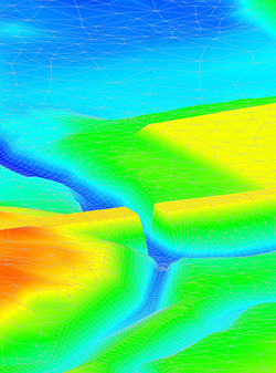
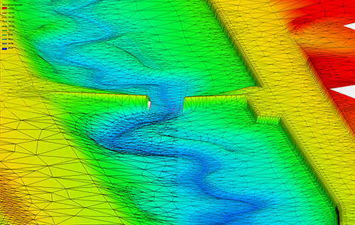
- HydroAS Mesh: Net-generator based on LIDAR-data for intelligent thinning of data and deriving of terrain edges
- HydroAS River Mesh: Efficient generating of 2D meshes for river channels
- JabPlot: Creating professional profile and longitudinal plots
HydroAS 5 - Improved user interface and performance
User Interface HydroAS
HydroAS 5 offers a user interface. This allows you to control calculation runs, test procedures and data export comfortably and clearly in one operating window.
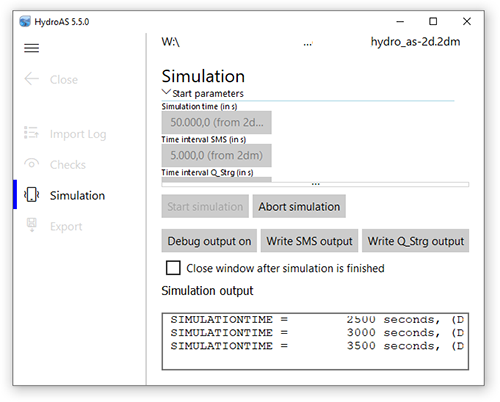
64-bit preprocessor and test functions
With the new 64-bit processor, data cheks are now much faster. The preprocessor performs extensive and plausibility checks.
Model control via scripting
Complex water management systems such as the control of weirs or outlet structures can be modeled more precisely using scripts. This is a unique feature that no other 2D hydraulic software program offers.
No limitations of model elements
The limitation for the maximum number of node strings, nodes in node strings as well as nodes of inflow hydrographs and water level/discharge relationships has been removed. The number is no longer limited here (limitation is the available memory).