We use cookies to make your experience better. To comply with the new e-Privacy directive, we need to ask for your consent to set the cookies. Learn more.
CMS Flow
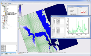
Hydrodynamic Coastal Flow Modeling with SMS
Application:Coastal Modeling
Method:2D Finite Volume
Developer:U.S. Army Corp of Engineers
Why CMS-Flow with SMS?
SMS provides a custom interface to the CMS-Flow model offering a simple way to set model parameters and a graphical user interface to run the model and visualize the results. Gather background data from a variety of sources from GIS to CAD and access online data from numerous databases of maps, images, and elevation data. SMS allows you to interact with models in true 3D taking advantage of optimized OpenGL graphics and to create photo-realistic renderings and animations for PowerPoint, print, and web presentations.
Try SMS Free for 14 Days >Purchase SMS with CMS-Flow >
CMS-Flow Description:
The hydrodynamic circulation model CMS-Flow is a component of the Coastal Modeling System developed by the US Army Corps of Engineers Coastal and Hydraulics Laboratory. CMS-Flow is a two-dimensional, finite-difference numerical approximation of the depth-integrated continuity and momentum equations. Cells are defined on a staggered, rectilinear grid and can have constant or variable side lengths. The momentum equations are solved in a time-stepping manner first, followed by solution of the continuity equation, in which the updated velocities calculated by the momentum equations are applied. The model simulates currents, water level, sediment transport, and morphology in the coastal zone. CMS-Flow was designed to model navigation channel performance and sediment exchanges between the inlet and adjacent beaches in the coastal zone.
- Robust flooding and drying
- Efficient grid storage in memory
- Time-varying wind and wave stress forcing
- Time-varying water level, tidal, and flow-rate forcing
- Variably-spaced bottom friction
- Independently turn on or off advective terms, mixing terms, salinity, sediment transport, morphology, and flooding/drying calculations