Virginia Well Permitting Program
Virginia Department of Environmental Quality

Overview
- Groundwater modeling support
- Arc hydro geodatabase development
- Custom Arc Hydro Groundwater tool development
- Development of GIS-based products
Applied Software
- GMS
- Arc Hydro Groundwater
- ArcGIS
Problem
 Virginia state law requires that all well permits undergo a formal review process prior to approval. This process includes determining the impact of the prospective well on neighboring wells and on the drawdown of the potentiometric surface to ensure that it does not fall below critical levels established by legislation. Prospective wells resulting in negative impacts are either rejected or required to develop a mitigation plan.
Solution
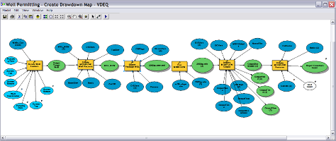 The impact of prospective wells has traditionally been modeled by VA-DEQ staff using a regional MODFLOW groundwater model. This process is labor-intensive and involves multiple steps leading to potential error. Aquaveo was hired by VDEQ to provide groundwater modeling in support of the well permit program. To do this, Aquaveo developed a new, automated system for modeling prospective wells using Arc Hydro Groundwater. The MODFLOW model is imported into a geodatabase using the MODFLOW Analyst tools. A custom GIS workflow is used to automate each step in the modeling process (create well feature -> update MODFLOW model -> run model, etc.). The products from the process include a series of GIS map layers and shape files.
Benefits
Automated GIS workflows have increased efficiency of the well permit evaluations and reduced the likelihood for error. The time savings has also allowed technical staff more time to analyze results. Other benefits is that the entire process is systematic, well-documented, and reproducable, and all intermediate and final products are non-proprietary. The framework also opens opportunities for web-based applications in the future.


